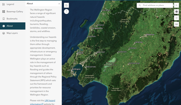
The Wellington Region faces a range of significant natural hazards including earthquakes, tsunamis, flooding, landslides, coastal erosion, storms, and wildfires.
Understanding our hazards is the first step to managing them either through appropriate development, infrastructure or emergency management. Greater Wellington plays an active role in the management of key hazards such as flooding and guides the management of others through the Regional Policy Statement (RPS) which sets out the framework and priorities for resource management in the Wellington Region.
Provision of hazard information
Greater Wellington recognises that land-use planning is the most effective tool for managing the risk from natural hazards, both in terms of saving lives and reducing damage to infrastructure and property.
A Land Information Memorandum (LIM) is a council-issued report that summarises all known information about a property, including natural hazards, consents, and zoning. LIMs must include certain natural hazard information that is “held by or known to” the Council. Recent amendments to the Local Government Official Information and Meetings Act (LGOIMA) will result in a more uniform approach to the inclusion of natural hazard information in LIMs. The key change for Greater Wellington is that hazard information held by or known to the organisation must be provided to the territorial authorities responsible for preparing LIMs.
We support employing a risk-based approach to development and avoiding inappropriate development in high hazard areas. This approach is required under the Regional Policy Statement (RPS) and proposed Change 1 to the RPS in Policies 29, 51 and 52 and in our adopted principles for flood risk management. To that end we support any efforts to make hazard information more available and accessible to all.
The Wellington Region Hazards LIM Map brings together all the hazards information provided for LIMs – check it out here.
Hazard information
Greater Wellington’s hazard information has been developed to help the public, local authorities and others manage risk and make informed decisions about their exposure to natural hazards. Local Council District Plans will hold more detailed hazard information and rules on how they are applied in your area.
Please note this information has been produced at a range of scales and may not be property specific. This information is periodically updated as new studies and modelling is carried out.
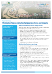
Climate change has the potential to exacerbate some of these hazards. More information about future changes to the regional climate can be found on our future impacts of climate change map and our climate change projections site.
Please contact Greater Wellington at info@gw.govt.nz for more information.
For information on fluvial flood hazard please contact the our Flood Advisory Team.
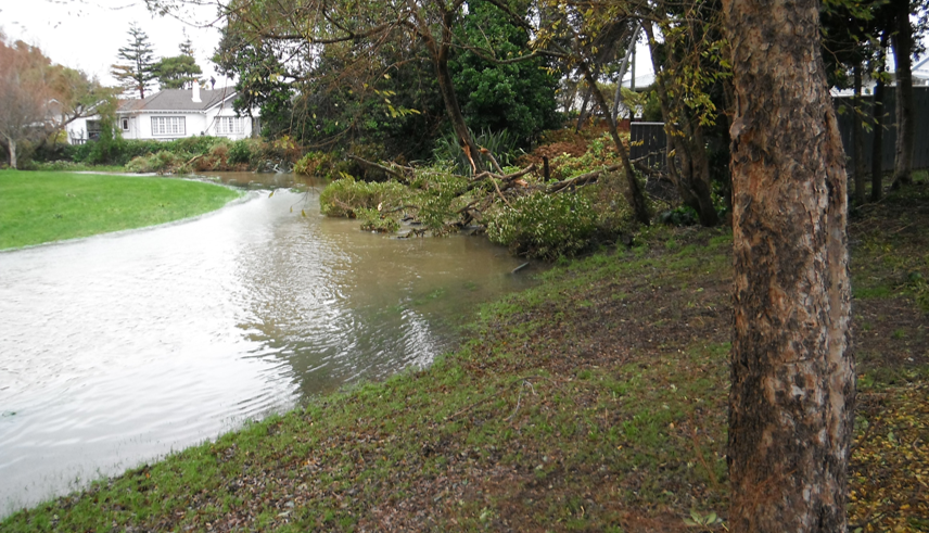
Fluvial (river) flood hazard


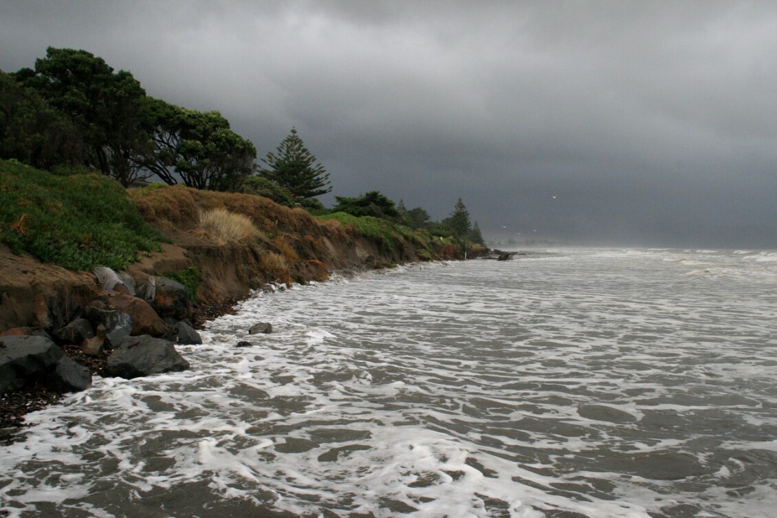
Coastal flood hazard
Tsunami hazard


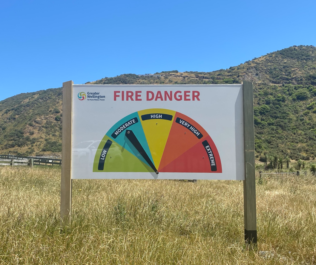
Wildfire hazard
Seismic hazard

Climate change hazard
Using this information
Guidance for Territorial Authorities
Greater Wellington has prepared template text for Territorial Authorities to copy into LIM reports (PDF 100 KB) .
Guidance has been produced to aid local authorities to meet the new requirements. It is provided for information only and cannot be relied on as evidence of complying with the requirements of sections 44A-D of the Act, or with the Regulations. This guidance does not cover information in a LIM/provided by a regional council to a territorial authority that does not relate to natural hazards. This guidance is available on the DIA website.
Guidance for members for the Public
Land Information Memorandum (LIM) - A LIM is the most comprehensive report you can get on a property. LIMs include historical and current information on commercial and residential properties.
- Kāpiti Coast LIM
- Porirua City LIM
- Wellington City LIM
- Hutt City LIM
- Upper Hutt LIM
- South Wairarapa District Council LIM
- Carterton District Council LIM
- Masterton District Council LIM
Managing the risk
Greater Wellington delivers a wide range of natural hazard risk management activities through:
Risk identification & analysis
- We model natural hazard such as flooding from major rivers and the sea, we work with agencies such as Earth Sciences New Zealand to understand seismic hazards that impact our region.
Risk management implementation
- We develop plans and policies to guide how the region responds to and manages natural hazards.
- We work with territorial authorities to implement a risk-based approach to land development.
- We construct and maintain stop banks and flood defences across the region.
- We are a member of the Wellington Regional Leadership Committee, working to better understand and respond to the impacts of hazards exacerbated by climate change across our region
- We work with the Wellington Regional Emergency Management Office to respond to natural disasters when they occur.
Be prepared
If your home, or place of work is vulnerable to a natural hazard we advise that you are prepared, with enough supplies for seven days and an effective emergency plan. For further guidance please visit the Wellington Regional Emergency Management Office website for more information. It is also recommended that you check that your insurance cover is appropriate for the hazards present.
Check out guidance on what to do before, during, and after natural hazard events such as earthquakes, floods, and tsunami.
Find out more about the region's flood risk from major rivers and the work Greater Wellington does to manage flood risk.
Learn more about Greater Wellington's targets and action plans in response to climate change.
See the regional policy settings for hazard management in our region.
Frequently asked questions
Is all natural hazard information included?
This page does not include all natural hazard information only those known to or mapped by Greater Wellington. The absence of hazard information does not necessarily mean the site is hazard free. For further information please visit your Local Authority for a LIM report.
Will this information affect my property value or insurance?
We have been advised by Quotable Value that valuations follow the market rather than set the market. A valuation is not discounted without there being market data to support that approach, and this was not the case from observations of the market at the time of valuations.
Many areas in the Wellington Region are subject to risk. We advise that any known facts relating to the physical risk to a property should be disclosed to an insurer. This includes whether the property is exposed to any hazard by virtue of its location (e.g. flood). An insurer requires these facts when evaluating whether to underwrite the risk and, if so, on what terms.
What is a 1% AEP (annual exceedance probability) event? Why use this event?
A 1% AEP (Annual Exceedance Probability) event is a flood event that has a 1% or one in 100 chance of occurring in any given year. This is sometimes referred to as a 1-in-100-year flood. We use this event for our flood hazard mapping as it is industry standard best practice.
How is climate change calculated?
Climate change is included in our assessment of flood and coastal hazards. Climate change assessments are made using the latest guidance from the Ministry for the Environment and consider both increases in rainfall and changes in sea level rise out to a 100-year time horizon.
Where to get other information
Get in touch
- Phone:
- 0800 496 734
- Email:
- info@gw.govt.nz