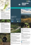
Haere mai, welcome to Pākuratahi Forest
location_on Location Located in the hills between Upper Hutt and Wairarapa
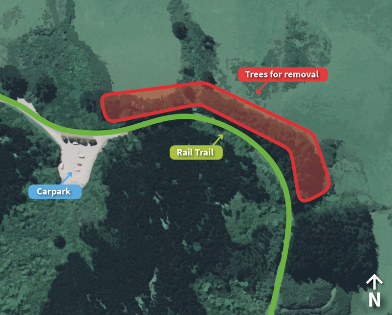
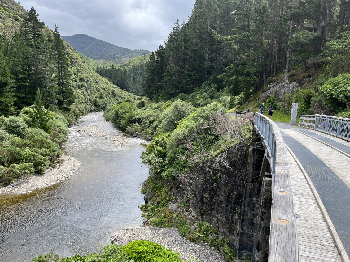
This is home to the rail trail section of the Remutaka Cycle Trail, one of New Zealand’s 22 Great Rides, and a popular biking route for groups and families that follows the old railway line through the Remutakas.
Opening hours
Parks are always open to foot traffic.
Vehicle gates are open 6am - 6pm in winter, and 6am - 8pm during daylight savings


Activities


Description
The forest covers 8,000ha on the western side of the Remutaka ranges north of Upper Hutt.
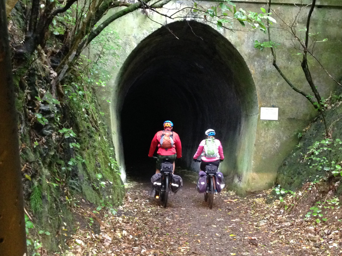
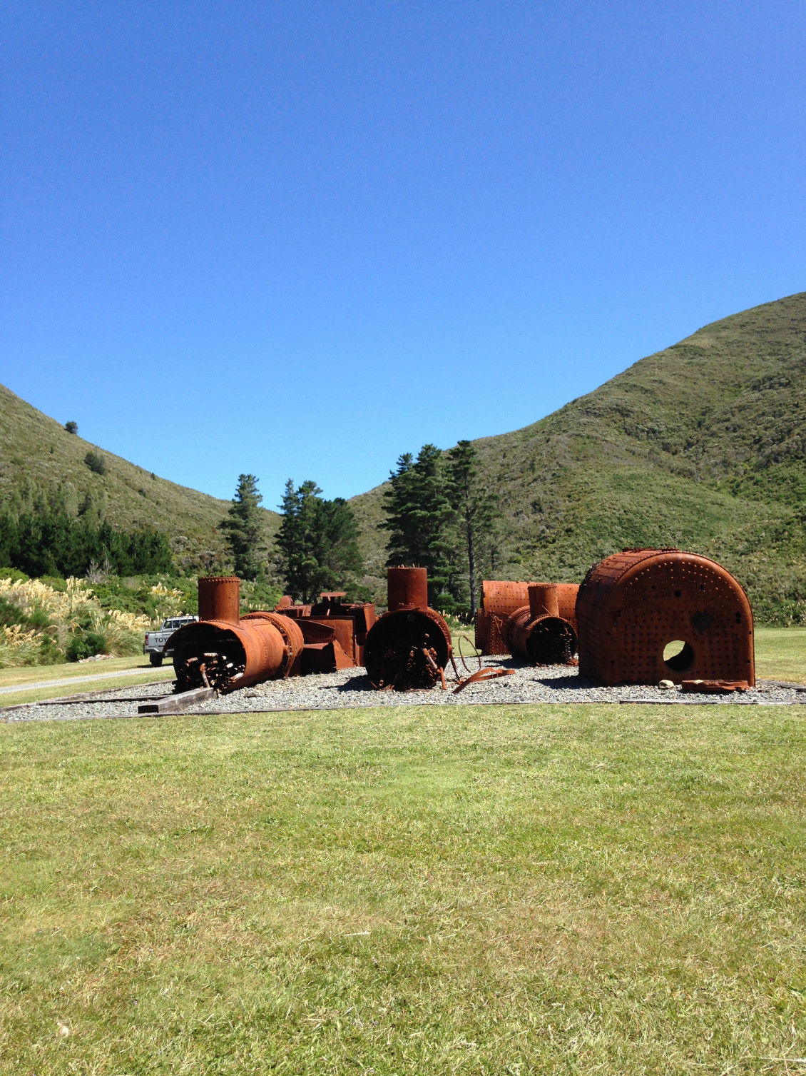
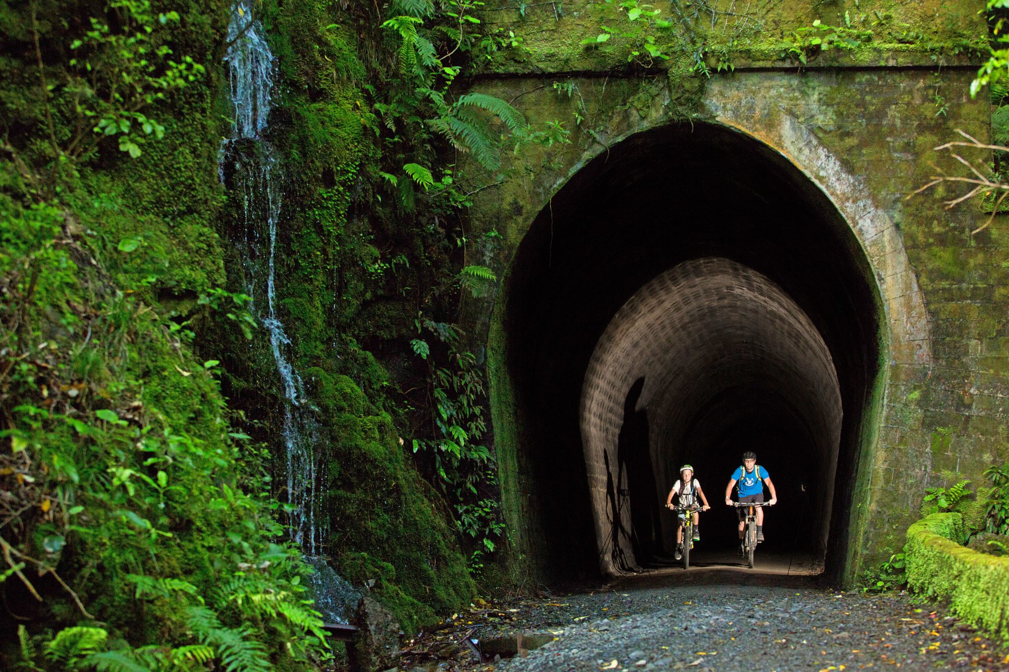
Did you know Queen Elizabeth II and Prince Philip travelled by rail over the Remutaka Range in 1954? This rail line is now the rail trail section of the Remutaka Cycle Trail, a popular walking and cycling track that includes the old rail tunnels.
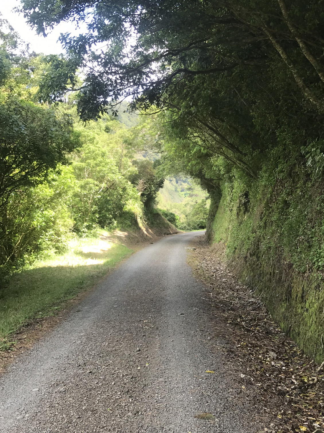
The area is best known for its walking, swimming, mountain biking. Take a leisurely walk through Tunnel gully or Tane’s Track. The one hour hike up Te Ara Tirohanga to the northern crest of the Remutaka Range has stunning views, so you will want to bring your camera.
Know before you go
- Logging operations - Vehicles may be using plantation forest for management and operational purposes. Only operational worksites are off limits to recreation use. Please adhere to signage and use caution while on these roads. Firewood collection is no longer permitted.
- Tracks are shared, so keep left and look out for horses and mountain bikes.
- Hunting with a permit is available in the Upper Pākuratahi and North Block.
Download the park brochure
Pākuratahi Forest brochure
date_range Published 08 Jul 2021
Download now (PDF 2.7 MB) get_appGetting there
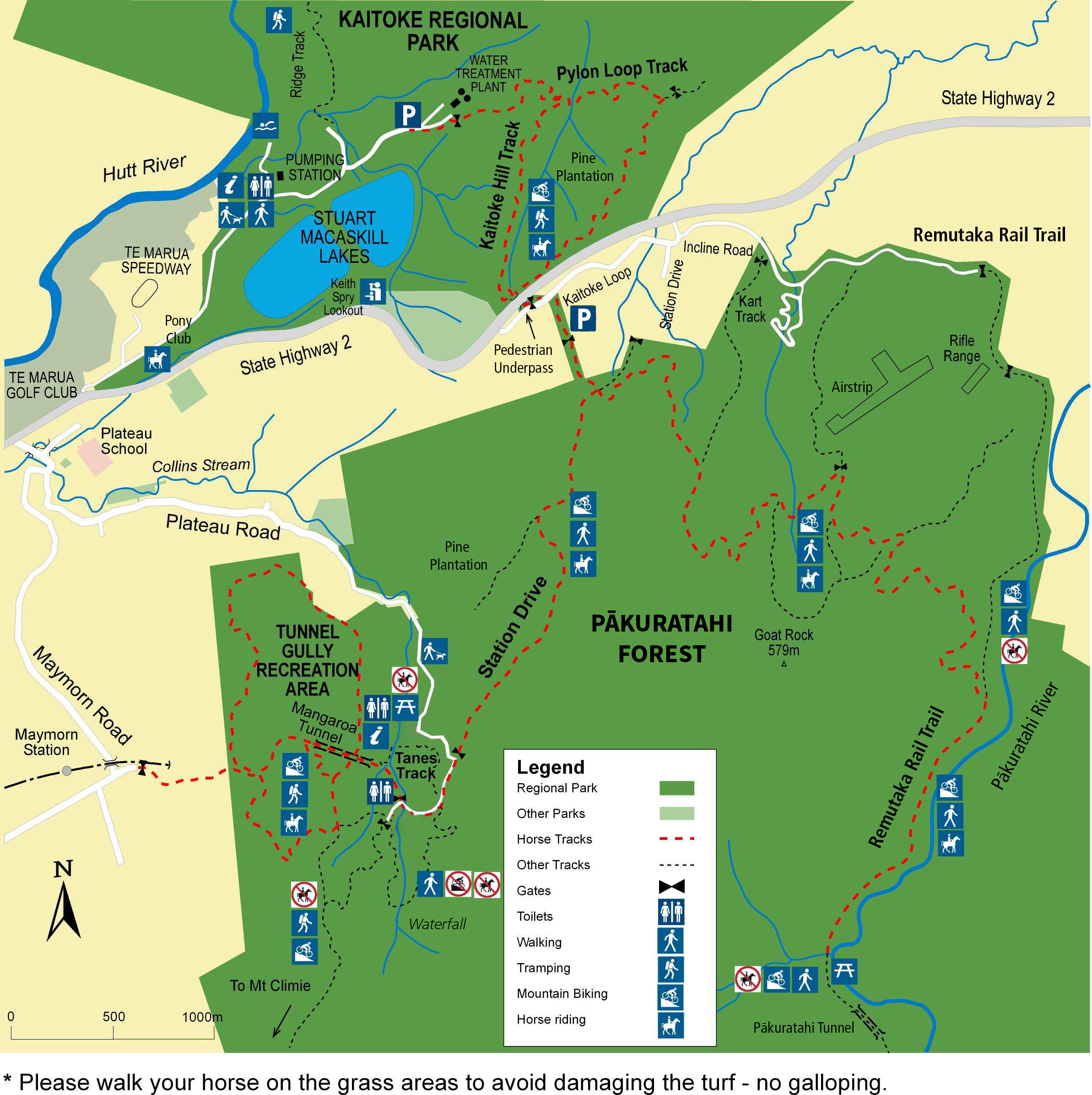
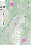
There are two main entrances to the Pākuratahi Forest
- The Tunnel Gully gives access to dog walking areas, picnic space, river swimming, Tane's Track and the historic Mangaroa Tunnel.
- Incline Road gives you access to the historic Remutaka Cycle Trail.
By public transport
Catch the route 112 bus from Upper Hutt Station to the last stop on the route (Stop 9627: Te Marua – Plateau Road). Walk approximately 1km to reach Tunnel Gully.
Catch the Metlink Wairarapa Line to Maymorn and walk or cycle 2km up the track and through the historic Mangaroa tunnel to Tunnel Gully. Follow the signs to the Remutaka Cycle Trail via the Old Railway Line track and the Kaitoke Loop Road. Enter through the Parkes line Road entrance.
Head to Metlink to plan your journey:

By bike
From the end of the Hutt River Trail at Te Marua you can continue on down the road past the Water Treatment plant and the Stuart MacCaskill Lakes to join onto an off road track that takes you to the start of the Remutaka Cycle Trail via an underpass under SH2. See the map to your right for more details.
From Maymorn Trailway Station you can follow the walking/cycling track that takes you through Tunnel Gully and you can join the Trail on Incline Road or further up the trail.
Plan your route from the Hutt River Trail or Hutt Valley train line with the Hutt Valley cycle map.
Hutt Valley Cycle Map 2021 | Ko te Mahere Pahikara o Te Awakairangi 2025
We are working on a new cycle map for the Hutt Valley. Due to impending additions to the cycle network this map will be published in 2026. Please email cycle.maps@gw.govt.nz… Read more here
date_range Published 06 Apr 2022
Download now (PDF 16 MB) get_appRemutaka Trig Track
Off SH2 just south of the summit of the Remutaka Hill Road.
- Remutaka Hill Road Summit, Ridgetop Track.
- Marchant Road (Kaitoke Shelter) via the Puffer Track. A permit is required from the Department of Conservation as this track passes through the Tararua Forest Park
By car
Tunnel Gully and Mt Climie
- Turn off SH2 onto Plateau Road at Te Marua, 6km north of Upper Hutt. Follow the signs to the park entrance at the end of Plateau Road. There is pedestrian and cycling access only beyond the carpark.
Remutaka Cycle Trail (via Incline Road)
- The signposted turn off from SH2 is 9km north of Upper Hutt. The Kaitoke carpark is a further 1.7km along a narrow road. Or you can enter the DOC managed section of the Trail via Cross Creek Road in the Wairarapa.
Get in touch
- Phone:
- 0800496734
- Email:
- info@gw.govt.nz