-
-
Rimutaka Trig Track - Pakuratahi Forest
The Rimutaka Trig Track is a 45 minute (return) walk, from near the
summit of Rimutaka Hill on State Highway 2 (around 555 metres above
sea level) to Rimutaka Trig…alarm Published 01 Aug 2002 -

-
Regional Outlook 2002 : Update - Export Sector Picks Up
In this issue of Regional Outlook, August 2002, we provide an update on
the most important developments in the Wellington regions economy,
since the start of the year.
A detailed analysis…alarm Published 01 Aug 2002 -
Proposed Regional Road Safety Strategy 2002/2007
The Proposed Road Safety Strategy 2010 recognises the significance of
the cost impacts on the community and New Zealand as a whole. It
outlines a planning process designed to facilitate…alarm Published 01 Aug 2002 -
Mount Climie Track - Pakuratahi Forest
Tunnel Gully Recreation Area nestles at the foot of Mount Climie (860m) in
the Pakuratahi Forest north of Upper Hutt.
The Mount Climie track gives you the opportunity to see the…alarm Published 01 Aug 2002 -
Akura conservation centre : 2002 Catalogue
Akura Conservation Centre : 2002 Catalogue gives details on prices for types of trees available from their nursery in Masterton. This catalogue includes a map of the local area to…
alarm Published 01 Jul 2002 -
Options for Managing Risks from Tsunami in the Wellington Region
Following on from previous work on tsunami hazard in the Wellington
Region, the Wellington Regional Council decided there needed to be a
more detailed investigation of options for…
alarm Published 01 Jul 2002 -
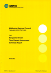
Mangaone Stream Flood Hazard Assessment Summary Report
Purpose of the Report
To assess flood hazards and inform floodplain management for the Mangaone Stream catchment.
Geographic Area Covered
The report covers the Mangaone Stream catchment, which originates in the western Tararua…
alarm Published 01 Jun 2002 -
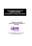
Hutt Corridor Plan for the Transport Network: Sustainability of Road Link Options
This study identifies present and future transport needs, and
deficiencies, in the transport route known as the Hutt Corridor.
It analyses key environmental and social sustainability measures
…
alarm Published 01 Jun 2002