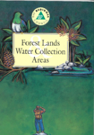
Skip to content Skip to main navigation Skip to footer
Greater Wellington Regional Council - logo
  • Te Taiao/ Environment
    • Our natural environment
    • Climate change
    • Pest management
    • Air quality
    • Land use
    • Freshwater
    • Harbours and coasts
    • Flood protection
    • Environmental incidents
    • Environmental data and information
  • Ngā Papa Whenua/ Parks
    • Akatarawa Forest
    • Battle Hill Farm Forest Park
    • Belmont Regional Park
    • East Harbour Regional Park
    • Hutt River Trail
    • Hutt Water Collection Area
    • Kaitoke Regional Park
    • Pākuratahi Forest
    • Queen Elizabeth Park
    • Wainuiomata Regional Park
    • Wairarapa Moana Wetlands
    • Whitireia Park
    • Concession applications
    • Permit applications
    • Implementing Toitū Te Whenua Parks Network Plan 2020-30
    • Looking after our parks
    • Keeping your dog safe in our region
    • Get involved
    • Parks survey
    • Wildfires in Regional Parks
    • Accommodation
  • Manatū Waka/ Transport
    • Metlink: bus, train and ferry
    • Getting around the region
    • Getting to school
  • Tō Rohe/ Your region
    • Emergency and hazard management
    • News
    • Calendar
    • Economic development
    • Get involved
    • Plans, policies and bylaws
    • Community research
    • Funding and awards
    • Education
    • Resource consents
    • Your rates
    • Open Data
  • Tō Kaunihera/ Your council
    • Who we are
    • Our role and activities
    • Our people
    • Mana whenua partners
    • Council and councillors
    • Council and Committee meetings
    • Local Governance Statement
    • Official Information
    • Elections
    • Job vacancies
    • Holidays Act Remediation
    • Legal
    • Contact Us

Whakataki
Search

search
Greater Wellington Regional Council - logo
    • Te Taiao/ Environment
    • Our natural environment
    • Climate change
    • Pest management
    • Air quality
    • Land use
    • Freshwater
    • Harbours and coasts
    • Flood protection
    • Environmental incidents
    • Environmental data and information
    • Ngā Papa Whenua/ Parks
    • Akatarawa Forest
    • Battle Hill Farm Forest Park
    • Belmont Regional Park
    • East Harbour Regional Park
    • Hutt River Trail
    • Hutt Water Collection Area
    • Kaitoke Regional Park
    • Pākuratahi Forest
    • Queen Elizabeth Park
    • Wainuiomata Regional Park
    • Wairarapa Moana Wetlands
    • Whitireia Park
    • Concession applications
    • Permit applications
    • Implementing Toitū Te Whenua Parks Network Plan 2020-30
    • Looking after our parks
    • Keeping your dog safe in our region
    • Get involved
    • Parks survey
    • Wildfires in Regional Parks
    • Accommodation
    • Manatū Waka/ Transport
    • Metlink: bus, train and ferry
    • Getting around the region
    • Getting to school
    • Tō Rohe/ Your region
    • Emergency and hazard management
    • News
    • Calendar
    • Economic development
    • Get involved
    • Plans, policies and bylaws
    • Community research
    • Funding and awards
    • Education
    • Resource consents
    • Your rates
    • Open Data
    • Tō Kaunihera/ Your council
    • Who we are
    • Our role and activities
    • Our people
    • Mana whenua partners
    • Council and councillors
    • Council and Committee meetings
    • Local Governance Statement
    • Official Information
    • Elections
    • Job vacancies
    • Holidays Act Remediation
    • Legal
    • Contact Us
home Home Document library

Documents Archive

  • Wainuiomata Tracks - East Harbour Regional Park

    Tracks from Wainuiomata offer short loop walks or longer tramps up to the

    main ridge overlooking Wellington Harbour.

    This brochure includes attractions and facilities, tracks and how to get

    there.

    There is no digital version of this document available, but you can get in touch with publications@gw.govt.nz to get a copy of the document.

    alarm Published 01 Jun 1996
  • Horse Riding - Battle Hill Farm Forest Park

    The 500 hectare Battle Hill property provides for a mixture of farming,

    forestry and recreation activities. Car and horse float parking, toilets,

    camping and picnicking facilities are available.

    This brochure includes…

    There is no digital version of this document available, but you can get in touch with publications@gw.govt.nz to get a copy of the document.

    alarm Published 01 Jun 1996
  • Wellington Regional Council Annual Plan 1996/97

    The Annual Plan is based on the Council's longer term plans as set out in

    the 10-year plan, "Facing the Future".

    The Annual Plan 1996/97 details the significant activities…

    There is no digital version of this document available, but you can get in touch with publications@gw.govt.nz to get a copy of the document.

    alarm Published 01 Jun 1996
  • Hydrological information for the Wellington metropolitan water supply area drought strategy

    In 1994 a report entitled Summary of Drought Strategy for the Wellington

    Metropolitan Water Supply Area was presented to the Metropolitan Water

    Supply Steering Group. The report, included as Appendix…

    There is no digital version of this document available, but you can get in touch with publications@gw.govt.nz to get a copy of the document.

    alarm Published 01 Jun 1996
  • Ngauranga Stream Water Quality Investigation

    The Wellington Regional Council report Baseline Water Quality of Rivers

    and Streams in the Wellington Region 1994/1995, identified the

    Ngauranga Stream as one of several water bodies having consistently

    poor…

    There is no digital version of this document available, but you can get in touch with publications@gw.govt.nz to get a copy of the document.

    alarm Published 01 Jun 1996
  • Wellington Combined Earthquake Hazard Map

    The Wellington Regional Council's earthquake hazard maps combine the

    separate components of earthquake risk (such as ground shaking, active

    faulting, slope failure, liquefaction, and tsunami potential) into single

    maps for…

    Download now (PDF 968 KB)

    alarm Published 01 Jun 1996
  • Hutt Valley Combined Earthquake Hazard Map

    The Wellington Regional Council's earthquake hazard maps combine the

    separate components of earthquake risk (such as ground shaking, active

    faulting, slope failure, liquefaction, and tsunami potential) into single

    maps for…

    Download now (PDF 1.1 MB)

    alarm Published 01 Jun 1996
  • Kapiti Combined Earthquake Hazard Map

    The Wellington Regional Council's earthquake hazard maps combine the

    separate components of earthquake risk (such as ground shaking, active

    faulting, slope failure, liquefaction, and tsunami potential) into single

    maps for…

    Download now (PDF 710 KB)

    alarm Published 01 Jun 1996
  • Porirua Combined Earthquake Hazard Map

    The Wellington Regional Council's earthquake hazard maps combine the

    separate components of earthquake risk (such as ground shaking, active

    faulting, slope failure, liquefaction, and tsunami potential) into single

    maps for…

    Download now (PDF 487 KB)

    alarm Published 01 Jun 1996
  • Stratton Street (Zone 2) Belmont Regional Park

    The Stratton Street entrance to Belmont Regional Park is a popular

    recreation area especially for horse riding and mountain biking. Walking,

    picnicking and camping are other activities enjoyed by visitors.

    This…

    There is no digital version of this document available, but you can get in touch with publications@gw.govt.nz to get a copy of the document.

    alarm Published 01 May 1996
  • Prev
  • 1
  • ...
  • 23
  • 24
  • 25
  • 26
  • 27
  • ...
  • 29
  • Next
Archive - Library
  • May 2025
  • April 2025
  • March 2025
  • February 2025
  • January 2025
  • 2024 - 2015
  • 2014 - 2005
  • 2004 - 1995
  • 1994 - 1970
  • Follow us on Facebook
  • Follow us on Instagram
  • Follow us on Youtube

Legal

  • About this site
  • Copyright
  • Privacy statement

Contact us

  • Contact us form
  • Office locations
  • Environment hotline
  • Media contact
  • Sign up to our newsletter open_in_new

Freephone: 0800 496 734

Greater Wellington Regional Council Logo, Te Pane Matua Taiao
Copyright © 2025 Greater Wellington Regional Council
New Zealand Government Logo