-
Ground Shaking Hazard 1992 October Wellington
Purpose to assess the ground shaking hazard in the Wellington area based on geological and seismological data.
alarm Published 01 Oct 1992 -
Ground Shaking Hazard 1992 October Porirua
Purpose of the report to assess the potential ground shaking hazard in Porirua and Tawa as part of a regional earthquake hazard mapping initiative.
alarm Published 01 Oct 1992 -
Ground Shaking Hazard 1992 October Upper Hutt
Purpose of the report to assess earthquake risks in the Wellington Region and identify mitigation options, focusing on ground shaking hazard.
alarm Published 01 Oct 1992 -
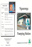
Ngauranga Pumping Station
Vital security of the regional water supply network is provided by the
Ngauranga Pumping Station. Officially opened in June1992 the pumping
station provides a crucial backup system should there be…
alarm Published 01 Oct 1992 -
Liquefaction and Ground Failure Hazards in Wellington 1992
Purpose of the report to review existing data and define the scope of further work needed to assess liquefaction and ground failure hazards in the Wellington Region. This Stage 1…
alarm Published 01 Oct 1992 -
Ground Shaking Hazard Wairarapa 1992
Purpose of the report to assess and describe the ground shaking hazard in the Wairarapa region based on geological and seismic data.
alarm Published 01 Oct 1992 -
Ground Shaking Hazard 1992 October Lower Hutt
purpose of the report to inform land use planning and public awareness by mapping ground shaking hazards in Lower Hutt based on geological and seismic data.
alarm Published 01 Oct 1992 -
Battle Hill Farm Forest Park Management Plan
Battle Hill has historic associations with Wellingtons establishment in the
1840s and is a fine example of a traditional New Zealand pastoral farm.
Its purchase by the Regional Council in…There is no digital version of this document available, but you can get in touch with publications@gw.govt.nz to get a copy of the document.
alarm Published 01 Jul 1992 -
Ground Shaking Hazard 1992 Kapiti
Purpose of the report to identify and map areas of varying earthquake ground shaking hazard along the Kapiti Coast using geological and seismic data.
alarm Published 01 Jun 1992 -
Ground Shaking Hazard October 1992 Kapiti
Purpose of the report to identify and map areas of varying earthquake ground shaking hazard along the Kapiti Coast using geological and seismic data.
alarm Published 01 Jun 1992